


Pemantauan Perubahan Garis Pantai Jangka Panjang dengan Teknologi Geo-Spasial di Pesisir Bagian Barat Kabupaten Tuban, Jawa Timur
Abstract
Abstrak
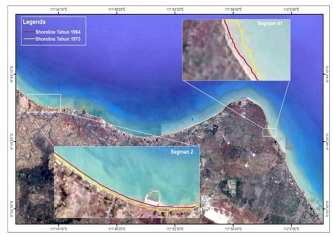
Pesisir Tuban bagian barat berpotensi mengalami perubahan garis pantai yang dipengaruhi oleh adanya pembangunan di wilayah pesisir berupa pelabuhan, permukiman, budidaya perikanan, dan reklamasi. Oleh karena itu perlu adanya pemantauan dinamika pesisir, kerusakan pesisir, dan perencanaan pembangunan pada kawasan pesisir. Penelitian ini bertujuan untuk mengetahui tren perubahan garis pantai jangka panjang dalam kurun waktu 1973-2018 dan memprediksi garis pantai di Tuban bagian barat. Penelitian ini memanfaatkan teknologi penginderaan jauh dan Sistem Informasi Geografis (SIG) untuk pemantauan perubahan garis pantai di pantai dengan Citra Landsat tahun 1973, 1988, 1998, 2008, 2017, and U.S Army Map Service tahun 1964. Perhitungan perubahan garis pantai menggunakan aplikasi Digital Shoreline Analysis System (DSAS) dengan menggunakan metode Net Shoreline Movement (NSM) dan End Point Rate (EPR) untuk menganalisis perubahan garis pantai yang telah terjadi, sedangkan metode Linear Regression Rate (LRR) digunakan untuk memprediksi perubahan garis pantai pada 10 tahun mendatang. Hasil penelitian menunjukkan bahwa di Pantai Tuban bagian barat akresi terbesar terjadi di Desa Remen yaitu sejauh 323 m dengan laju akresi sebesar 7,32 m/tahun. Sebaliknya abrasi tertinggi dialami oleh Desa Mentosa dengan rata-rata jarak abrasi sebesar 181,90 m dan rata-rata laju abrasi sejauh 4,11 m/tahun. Prediksi perubahan garis pantai untuk 10 tahun kedepan mengindikasikan terjadinya akresi di Desa Glodonggede dan abrasi di Desa Mentosa.
Kata kunci: Garis Pantai, Akresi, Abrasi, Pemantauan, DSAS
Abstract
The western Tuban coast has the potential to experience shoreline changes influenced by the development in coastal areas in the form of ports, settlements, aquaculture and reclamation. Therefore, it is necessary to monitor coastal dynamics, coastal damage, and development planning in coastal areas. This study aims to determine the trend of long-term shoreline changes in the period 1973-2018 and predict coastlines in the western part of Tuban. This study uses remote sensing technology and Geographic Information System (GIS) to monitor changes in coastlines on the western coast of Tuban Regency with Landsat imagery in 1973, 1988, 1998, 2008, 2017, and US Army Map Service in 1964. Calculation of shoreline changes using Digital Shoreline Analysis System (DSAS) application using Net Shoreline Movement (NSM) and End Point Rate (EPR) methods to determine shoreline changes, while the Linear Regression Rate (LRR) method is used to predict shoreline changes in the next 10 years. The results showed that in the western part of Tuban Beach the largest accretion occurred in the village of Remen which was 323 m with an accretion rate of 7.32 m / year. Conversely, the highest abrasion was experienced by Mentosa Village with an average abrasion distance of 181.90 m and an average abrasion rate of 4.11 m / year. Predictions of shoreline changes for the next 10 years indicate the occurrence of accretion in Glodonggede Village and abrasion in Mentosa Village
Keywords: Shoreline, Accretion, Abrasion, Monitoring, DSAS
Full Text:
PDFReferences
Arief , M., Winarso, G. & Prayogo, T. (2011). Kajian Perubahan Garis Pantai Menggunakan Data Satelit Landsat di Kabupaten Kendal. Jurnal Penginderaan Jauh , Volume 8, pp. 71-80.
Fuad, MAZ. Setiani, M.A. (2017). Automatic Detection of Decadal Shoreline Change on Northern Coastal of Gresik, East Java – Indonesia. IOP Conference Series: Earth and Environmental Science, Volume 98, conference 1
Hidayati , N. (2017). Dinamika Pantai. Malang : UB Press.
Istiqomah, F., Sasmito, B. & Amarrohman, F. J. (2016). Pemantauan Perubahan Garis Pantai Menggunakan Aplikasi Digital Shoreline Analysis System (DSAS) Studi Kasus Pesisir Kabupaten Demak. Jurnal Geodesi UNDIP, Volume 5 (1), pp. 78-89.
Ji, L. et al. (2015). Target Detection Method for Water Mapping Using Landsat 8 OLI/TIRS Imagery. Water, Volume 7, pp. 794-817.
Kalay, D. E., Manilet, K. & Wattimury, J. J. (2014). Kemiringan Pantai dan Distribusi Sedimen Pantai di Pesisisir Utara Pulau Ambon. Jurnal TRITON, Volume 10 (2), pp. 91-103.
Kasim , F. & Salam, A. (2015). Identifikasi Perubahan Garis Pantai Menggunakan Citra Satelit serta Korelasinya dengan Penutupan Lahan di Sepanjang Pantai Selatan Provinsi Gorontalo. Jurnal Ilmiah Perikanan dan Kelautan , Volume 3 (40, pp. 160-167.
Marfai, M. A. et al. (2011). Model Kerentanan Wilayah Pesisir Berdasarkan Perubahan Garis Pantai dan Banjir Pasang (Studi Kasus : Wilayah Pesisir Pekalongan). Yogyakarta: UGM.
Pranoto, S. (2007). Prediksi Perubahan Garis Pantai Menggunakan Model Genesis. Berkala Ilmiah Teknik Keairan, Volume 13 (3), pp. 145-154.
Richard. (2015). Perubahan Garis Pantai dan Kerusakan Pantai di Kawasan Kepesisiran Kabupaten Tuban Bagian Barat. Jurnal Bumi Indonesia, Volume 4 (4).
Setyawan , W. B. (2001). Karakteristik Sumberdaya dan Proses Pesisir : Alasan Perlunya Kerjasama dalam Mengelola Wilayah Pesisir. Energi, Sumberdaya Alam dan Lingkungan.
Suniada, K. I. (2015). Deteksi Perubahan Garis Pantai di Kabupaten Jembrana Bali dengan Menggunakan Teknologi Penginderaan Jauh. Jurnal Kelautan Nasional, Volume 10 (1), pp. 13-19.
Sutikno, S. (2014). Analisis Laju Abrasi Pantai Pulau Bengkalis dengan Menggunakan Data Satelit. ResearchGate.
USGS. (2009). Digital Shoreline Analysis System. s.l.:s.n.
Xu, H. (2006). Modification of Normalised Difference Water Index (NDWI) to Enhance Open Water Features in Remotely Sensed Imagery. International Journal of Remote Sensing, Volume 27 (14), pp. 3025-3033.
DOI: https://doi.org/10.24114/jg.v11i1.11409
Article Metrics
Abstract view : 2457 timesPDF - 2512 times
Refbacks
- There are currently no refbacks.
Accredited Journal, Based on Decree of the Minister of Research, Technology and Higher Education, Republic of Indonesia Number 36/E/KPT/2019
Copyright ©2020 Jurusan Pendidikan Geografi Fakultas Ilmu Sosial Universitas Negeri Medan dan Ikatan Geograf Indonesia (IGI)

This work is licensed under a Creative Commons Attribution-NonCommercial 4.0 International License.